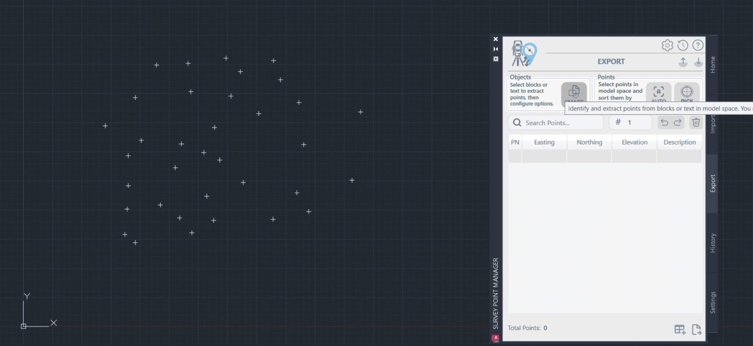
How to Export Points
Export points from AutoCAD in 3 different ways: Manual, Auto, and Smart selection with screenshots.
How to Export Points
3 ways to select and export points
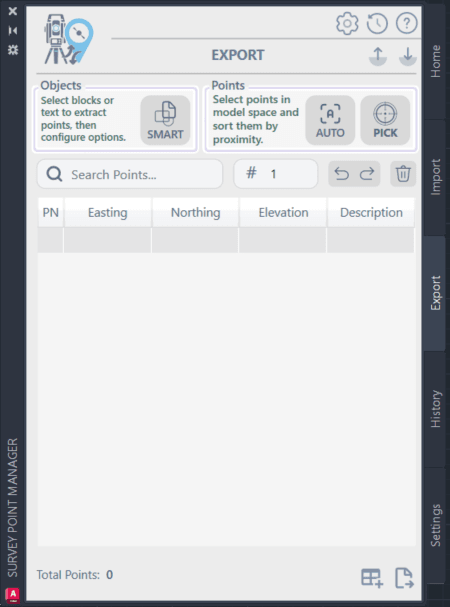
3 Ways to Select Points
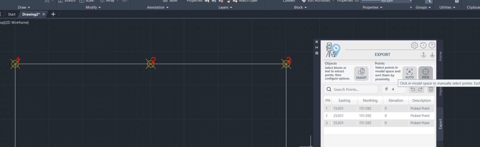
Method 1: Manual Pick (Few Points)
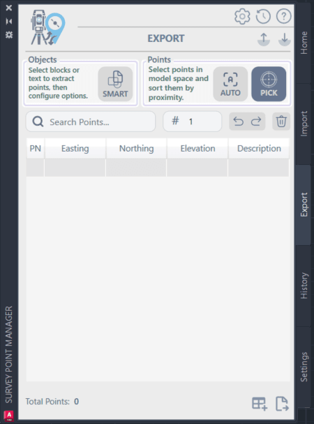 When to use: 5-20 points, specific selection
How to do it:
- Press PICK button
- Click points in drawing one by one
- Press PICK again to finish
Method 2: Auto Pick (Many Points)
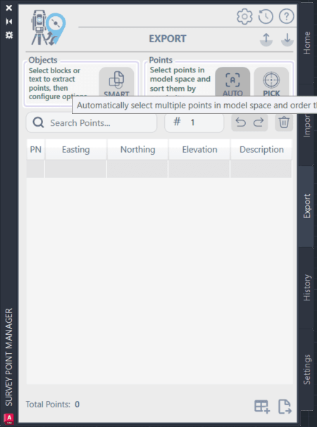 When to use: 20+ points, need renumbering
How to do it:
- Press AUTO button
- Enter starting point number
- Select all points you want
- Press Enter
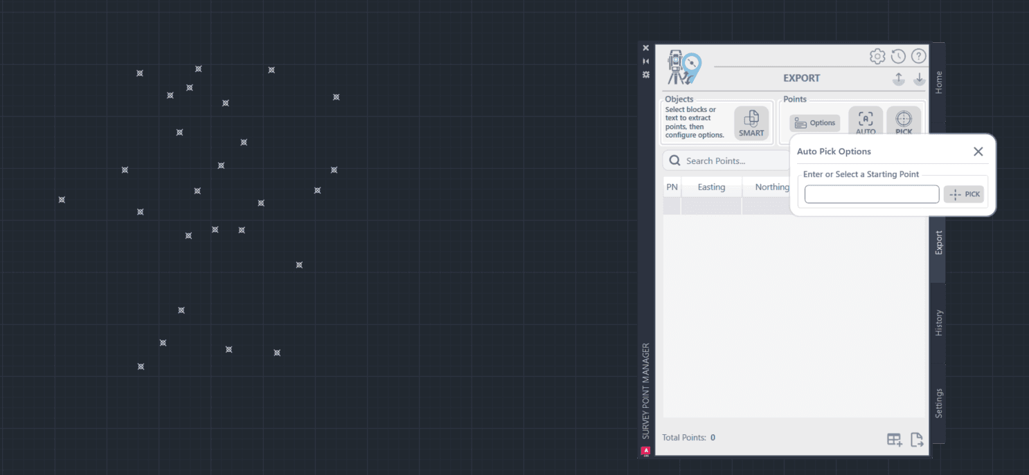
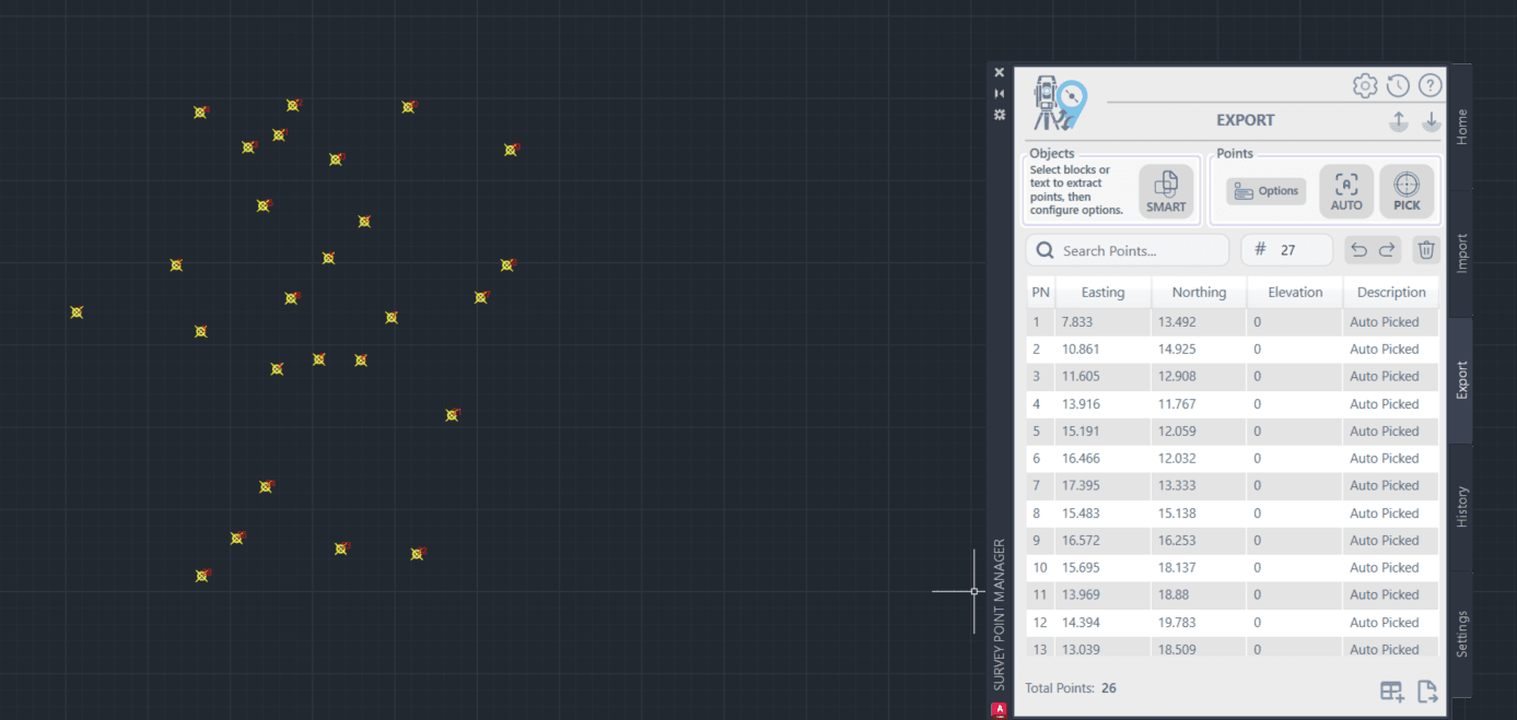 Result: Points automatically renumbered starting from your number
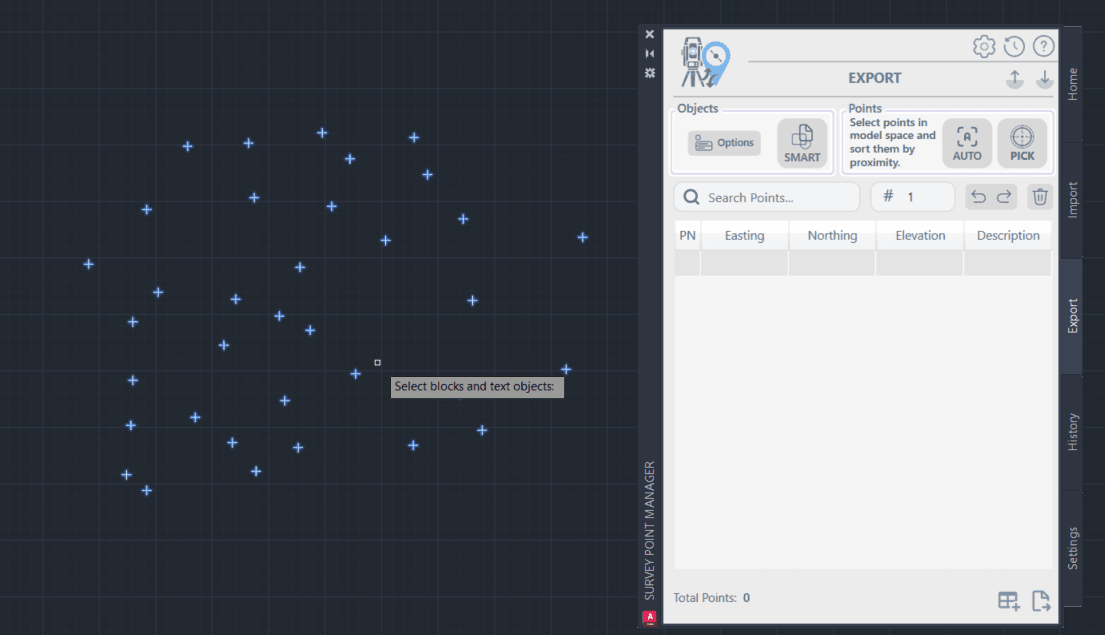
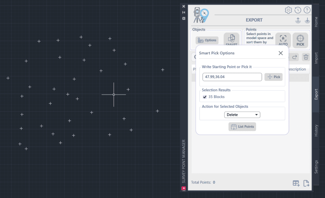
Method 3: Smart Pick (Blocks/Text)
 When to use: Convert blocks or text to points
How to do it:
- Press SMART button
- Set starting point
- Select blocks or text objects
- Choose which ones to convert
Export Your Points
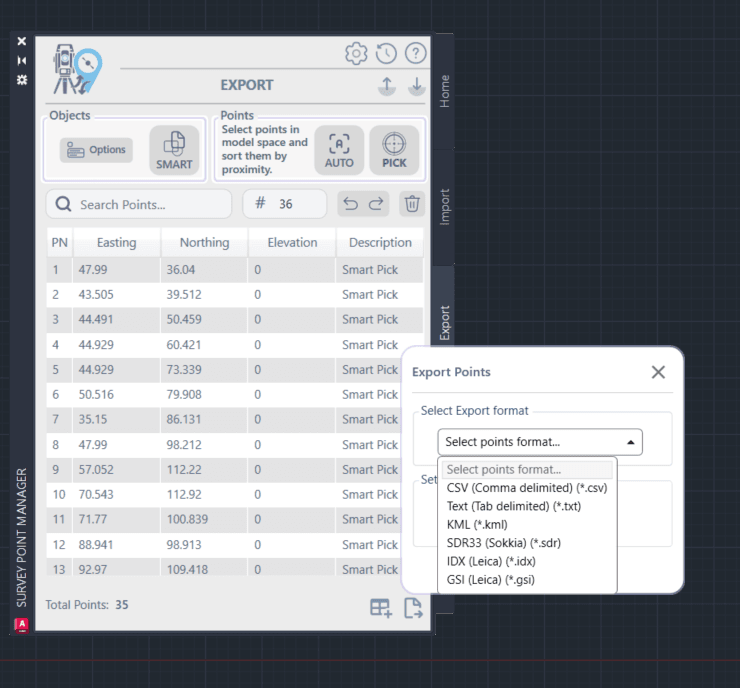
Available formats:
- CSV: For Excel, databases
- TXT: For other software
- GSI: For Leica equipment
- KML: For Google Earth
- IDX: For archiving
Create Table
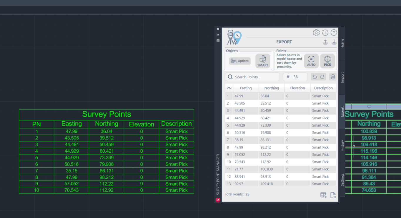
How to do it: Click "Draw Points Table" Result: Professional table in your drawing
Tip: Set MaxRows in Settings first (5, 15, 25, or 50 rows per table)
Export Formats Overview
Survey Points Manager supports exporting to all major survey and CAD file formats, ensuring compatibility with other software and equipment.
Text-Based Export Formats
CSV (Comma-Separated Values)
- Universal Compatibility: Works with Excel, databases, and most software
- Customizable Structure: Configurable column order and delimiters
- Header Options: Include or exclude column headers
- Data Selection: Export all points or selected subset
- Common Use: Data analysis, reporting, software integration
TXT (Text Files)
- Flexible Formatting: Space, tab, or custom delimited
- Fixed-Width Options: Fixed-width column formatting
- Custom Templates: User-defined export templates
- Legacy Support: Compatible with older survey software
- Common Use: Total station import, legacy software, custom applications

Geographic Export Formats
- Google Earth: Direct import into Google Earth
- Geographic Coordinates: Automatic coordinate conversion
- Visualization: 3D point visualization with descriptions
- Styling Options: Point symbols and colors
- Common Use: Site visualization, client presentations, GIS integration
Survey Equipment Formats
SDR (Sokkia Data Recorder)
- Native Format: Direct import to Sokkia equipment
- Point Codes: Preserve point codes and descriptions
- Measurement Data: Include measurement information
- Quality Control: Maintain data integrity
- Common Use: Field data transfer, equipment synchronization
IDX (Survey Index Files)
- Index Format: Standard survey index format
- Coordinate Data: Point coordinates and descriptions
- Batch Export: Multiple project export
- Archive Format: Long-term data storage
- Common Use: Data archiving, software exchange
GSI (Leica GSI Format)
- 8-bit GSI: Standard GSI format export
- 16-bit GSI: Extended GSI format export
- Equipment Compatibility: Direct import to Leica equipment
- Complete Data: Coordinates, codes, and attributes
- Common Use: Leica total stations, survey software integration

Export Process
Opening Export Interface
- Navigate to the Export tab in SPM
- Click Open Export Dialog button
- The export configuration dialog will appear
- Select your desired export format from the dropdown
Export Dialog Components
- Format Selection: Choose export format
- Configuration Options: Format-specific settings
- File Destination: Output file location and name
- Data Selection: Choose which points to export
- Preview: Sample of export output
 Image Description: Screenshot of the export dialog showing format selection dropdown, configuration options panel, file destination settings, and data selection controls. The interface demonstrates the step-by-step export configuration process.
Step 2: Format Configuration
CSV/TXT Export Configuration
Column Selection
- Point Numbers: Include point identifiers
- Coordinates: Easting, Northing, Elevation
- Descriptions: Point descriptions or codes
- Custom Fields: Additional data fields
- Column Order: Configurable column arrangement
Formatting Options
- Delimiter: Comma, semicolon, tab, space, or custom
- Headers: Include column headers in first row
- Text Qualifiers: Quote text fields if needed
- Number Format: Decimal places and notation
- Coordinate Order: XY or YX coordinate order
 Image Description: Detailed view of CSV export configuration showing column selection checkboxes, delimiter options, header settings, and formatting controls. The interface includes a preview of how the exported data will appear.
KML Export Configuration
Coordinate System Settings
- Source UTM Zone: Current coordinate system
- Target System: Geographic (WGS84) coordinates
- Hemisphere: North or South hemisphere
- Datum Transformation: Coordinate system conversion
Visualization Options
- Point Symbols: Choose point marker style
- Point Colors: Color coding options
- Label Display: Show point numbers and descriptions
- Elevation Display: 3D height visualization
- Description Format: Point information display
 Image Description: Screenshot of KML export configuration interface showing coordinate system settings, visualization options, and point styling controls. The image includes a preview of how points will appear in Google Earth.
Step 3: Data Selection
Export Scope Options
All Points
- Export complete dataset
- Include all imported points
- Maintain original order
- Full data integrity
Selected Points
- Export only selected points from grid
- Use Ctrl+Click or Shift+Click to select
- Maintain selection order
- Partial dataset export
Filtered Points
- Export based on current filter settings
- Use search and filter tools first
- Export matching criteria only
- Dynamic selection based on filters
 Image Description: Interface showing data selection options with radio buttons for All Points, Selected Points, and Filtered Points. The image demonstrates how users can choose which data to include in their export.
Step 4: File Destination and Export
File Naming and Location
Destination Folder
- Browse to desired output location
- Create new folders if needed
- Consider network vs. local storage
- Ensure write permissions
File Naming
- Use descriptive file names
- Include project or date information
- Follow naming conventions
- Avoid special characters
File Extension
- Automatically added based on format
- Can be customized if needed
- Ensure compatibility with target software
- Consider file association settings
Export Execution
- Review all configuration settings
- Click Export button to begin
- Monitor progress for large datasets
- Confirm successful export completion
- Verify output file creation
 Image Description: Screenshot showing the final export step with file destination selection, export button, and progress indicator. The image demonstrates the completion of the export configuration process.
Advanced Export Features
Batch Export
Multiple Format Export
- Simultaneous Export: Export to multiple formats at once
- Format Templates: Save configuration templates
- Batch Processing: Process multiple datasets
- Automated Workflow: Streamlined export process
Template Management
- Save Templates: Store frequently used configurations
- Load Templates: Quick setup with saved settings
- Share Templates: Export templates for team use
- Template Library: Organize configuration templates
 Image Description: Interface showing batch export options with multiple format selection, template management controls, and automated processing options.
Data Transformation During Export
Coordinate Transformation
- Unit Conversion: Convert between meters, feet, etc.
- Coordinate System: Transform to different systems
- Offset Application: Apply coordinate offsets
- Rotation: Apply coordinate rotation
Data Filtering and Processing
- Point Range: Export specific point number ranges
- Description Filter: Filter by point descriptions
- Coordinate Bounds: Export within coordinate limits
- Quality Filter: Export based on data quality
Custom Export Formats
User-Defined Templates
- Custom Delimiters: Define custom separator characters
- Field Arrangement: Custom column order and content
- Header Customization: Custom header text and format
- Data Formatting: Custom number and text formatting
Format Validation
- Output Verification: Validate exported data
- Format Checking: Ensure format compliance
- Error Detection: Identify export issues
- Quality Assurance: Maintain data integrity
 Image Description: Interface for creating custom export templates showing field arrangement options, formatting controls, and template validation features.
Performance Optimization
Large Dataset Export
.NET 8 Version Advantages
- Memory Efficiency: Optimized memory usage for large exports
- Processing Speed: 25% faster export processing
- Background Processing: Non-blocking export operations
- Progress Feedback: Real-time export progress updates
Legacy Version Considerations
- File Size Limits: Recommended limits for optimal performance
- Memory Management: Monitor system resources during export
- Batch Processing: Split large exports into smaller files
- System Optimization: Close unnecessary applications
Export Speed Optimization
Data Preparation
- Filter First: Apply filters before export to reduce data size
- Select Efficiently: Use selection tools for partial exports
- Clean Data: Remove unnecessary points before export
- Organize Points: Sort points for faster processing
System Optimization
- Available Memory: Ensure sufficient RAM for large exports
- Disk Space: Verify adequate free space for output files
- Local Storage: Export to local drives for better performance
- Background Tasks: Minimize other system activities
 Image Description: Performance monitoring interface showing memory usage, export progress, and optimization recommendations for large dataset exports.
Quality Control and Validation
Export Verification
Data Integrity Checks
- Point Count: Verify correct number of points exported
- Coordinate Accuracy: Check coordinate precision and format
- Description Preservation: Ensure descriptions exported correctly
- Format Compliance: Validate output format standards
Post-Export Validation
- File Size: Verify reasonable file size
- Format Testing: Test import in target software
- Data Comparison: Compare exported vs. original data
- Quality Metrics: Check data quality indicators
Error Handling
Common Export Issues
- Insufficient Disk Space: Ensure adequate storage
- File Permission Errors: Check write permissions
- Format Compatibility: Verify target software compatibility
- Data Corruption: Validate data integrity
Error Resolution
- Diagnostic Tools: Use built-in diagnostic features
- Error Logs: Review detailed error information
- Support Resources: Access help documentation
- Technical Support: Contact support for complex issues
 Image Description: Quality control dashboard showing data integrity checks, validation results, and error reporting features for export operations.
Best Practices
Export Planning
Project Organization
- Consistent Naming: Use standardized file naming conventions
- Folder Structure: Organize exports by project, date, or format
- Version Control: Track export versions and changes
- Documentation: Document export settings and purposes
Data Management
- Backup Strategy: Maintain backups of exported data
- Archive Organization: Organize long-term data storage
- Access Control: Manage file permissions and access
- Retention Policy: Establish data retention guidelines
Format Selection Guidelines
Choose Based on Use Case
- CSV: For data analysis, reporting, and general use
- TXT: For legacy software and custom applications
- KML: For visualization and GIS integration
- SDR/GSI: For survey equipment and field work
- IDX: For data archiving and long-term storage
Compatibility Considerations
- Target Software: Ensure format compatibility
- Version Requirements: Check software version support
- Feature Support: Verify all required features supported
- Testing: Test imports in target applications
Workflow Integration
Team Collaboration
- Shared Templates: Use consistent export templates
- Standard Formats: Establish team format standards
- Quality Procedures: Implement quality control processes
- Communication: Document export procedures for team
Client Deliverables
- Client Requirements: Understand client format needs
- Quality Standards: Meet professional quality standards
- Documentation: Provide export documentation
- Support: Offer technical support for deliverables
 Image Description: Infographic showing export best practices including project organization, format selection guidelines, and workflow integration recommendations.
Troubleshooting Export Issues
Common Problems and Solutions
Export Fails to Complete
Possible Causes:
- Insufficient disk space
- File permission issues
- Large dataset memory limitations
- Software conflicts
Solutions:
- Check available disk space
- Verify file write permissions
- Try exporting smaller datasets
- Close other applications
Exported Data Appears Incorrect
Possible Causes:
- Wrong format configuration
- Incorrect coordinate system settings
- Data selection issues
- Format compatibility problems
Solutions:
- Review export configuration settings
- Verify coordinate system parameters
- Check data selection criteria
- Test with different export formats
 Image Description: Visual troubleshooting guide showing common export error scenarios and their step-by-step solutions with screenshots and diagnostic information.
Survey Points Manager - Professional data export for all your needs
Ready to convert between formats? Continue with the Data Conversion Guide to learn about format conversion techniques.
Need export assistance? Contact our support team for help with complex export requirements and custom format needs.
Survey Points Manager - Data Conversion Guide
Master data conversion techniques in Survey Points Manager. Learn to convert between CSV, TXT, KML, SDR, IDX, and GSI formats efficiently and accurately.
Survey Points Manager - History Management Guide
Complete guide to managing operation history in Survey Points Manager with enterprise-level tracking features. Learn advanced search, operation logging, and audit trails with visual interface walkthrough.
Leave a Comment